Due to the health concerns created by Coronavirus we are offering personal 1-1 online video walkthough tours where possible.


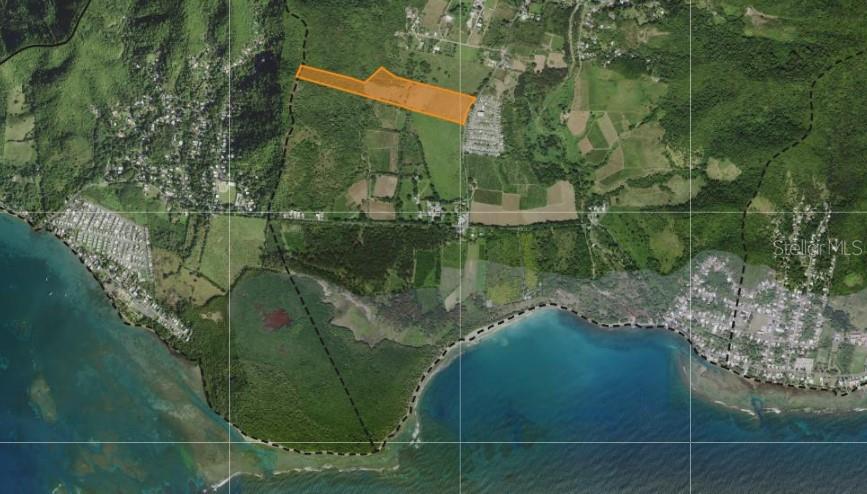
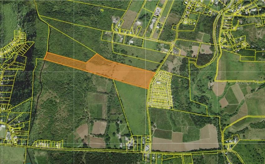
145 ACRES OF CONTINUOUS LAND - 586,794 SQ MTS OF PRISTINE LAND FOR FARMING - BO JACABOA WARD, PATILLAS, PR LAND CLASIFICATION: SREP-A = SUELO RUSTICO ESPECIALMENTE PROTEGIDO AGRICOLA + DUAL ACCESS VIA PR RD-3 + PR RD-758 GPS: 17.979315, -65.975071 - Two large contiguous parcels of land on the island's southeastern side with mountainous and coastal areas. Patillas, known as "The Emerald of the South," its natural beauty resembles the El Yunque national Caribbean rainforest. - The location enjoys a healthy environment with elevated levels of rainfall and a natural aquifer presence. The coastal alluvial plain of 150+ cuerdas or 145+ Acres is bound to the North by the Cordillera Central of PR. There is no shortage of natural water as the farm sits upon a natural aquifer that once tapped to a depth of 40 feet below the surface and underlined the broad expanse of the land. - The alluvium deposits by downward flowing streams have resulted in fertile soil ideal for harvesting varied crops such as plantains, vegetables, etc. Suitable for farming and raising horses, pigs, chickens, goats, etc. All growing areas are well accessible by road paths that encircle the land, accessible either via PR RD-3 or PR RD-758. - Property A features an underground ravine that runs through the land and connects with a natural spring water body. The clearing of the land would make it suitable for agricultural development. On a "Terrapin" or flat area up on a 60 feet elevation, trees growing in a wind-sept fashion indicate the presence of strong winds that potentially could be used for harvesting and installing wind turbines. - The available 150+ cuerdas or 145+ Acres of land (586,794 Sq Mts) consist of two separate yet continuous farms with approximately 900 meters of coastal PR RD- 3 frontages—almost one-kilometer direct access PR RD-3. - High-tension power lines from the local power grid known as "AEE-LUMA" run through the land's frontage and reach high elevations. - These high-tension power lines are from the Thermoelectric Power Plant in Guayama. Three neighboring power plants exist in the Cayey, Guayama, and Salinas towns. - The neighboring PR power plants are Martin Energy Group-Cayey, AES Power Plant-Guayama, and AEE-LUMA PREPA Aguirre Plant-Salinas, respectively. - 586,794 SQ MTS CONTINUOUS LAND LOT SIZE - PROPERTY A 121.6654 CUERDAS = 118.16 ACRES - PROPERTY B 28.50 CUERDAS = 27.67 ACRES + CONTINUOUS DUAL ROAD ACCESS: PROPERTY A w/Direct Access PR RD-3 (Coastal Road) PROPERTY B w/Direct Access PR RD-758 - DRIVING FROM SAN JUAN TO PATILLAS: PR HWY 52, A/K/A Autopista Luis A. Ferré. Exit PR RD-53 East-aAfter Salinas Toll into Patillas. The vast land lot will be on the left of the right oceanfront. - All information provided is for general information purposes only. Serious inquiries, please.
| 3 months ago | Listing updated with changes from the MLS® | |
| 3 years ago | Status changed to Active | |
| 3 years ago | Listing first seen on site |

All SVN® Offices Independently Owned and Operated | © 2026 SVN McDonald & Company | Powered by Searchalytics
Did you know? You can invite friends and family to your search. They can join your search, rate and discuss listings with you.